
Coastal E 22'' ECS, panel-pc AC/DC
SKU:
983000424
EAN: 983000424Coastal E is an electronic chart system (ECS) in line with Norwegian requirements for electronic chart systems as replacement for paper charts, as outlined in the Norwegian Maritime Directorate's circular RSV 14-2022 and RSV 16-2022. Coastal E is accepted for vessels up to 24 meters that don't have carriage requirement for ECDIS. Coastal E 2224 is a panel-pc with a 22” display. The solution is based on TECDIS. It is just as user-friendly and includes the same functionality, however it is not a wheelmarked ECDIS.
Electronic chart system (ECS) approved for paperless navigation
- Electronic chart system tailored for vessels up to 24 meters
- In accordance with the Norwegian Maritime Authority's circulars RSV 14-2022/16-2022
- Delivered as a panel PC with 22” display
- Multipower 230 VAC / 24 VDC and IP sensor connections
- Can be configured as a multifunction display (MFD)
- Optional: Armrest panel FK 2020
- Supports multiple overlay types
Coastal E is developed to offer a modern and approved chart solution for vessels not required to carry ECDIS, enabling paperless navigation. With Coastal E, you can navigate safely with up-to-date charts and benefit from many useful features that enhance safety and situational awareness. Coastal E is based on TECDIS, perhaps Norway’s most widely used ECDIS, developed over many years in close collaboration with Norwegian navigators and well adapted to coastal navigation in Norwegian waters.
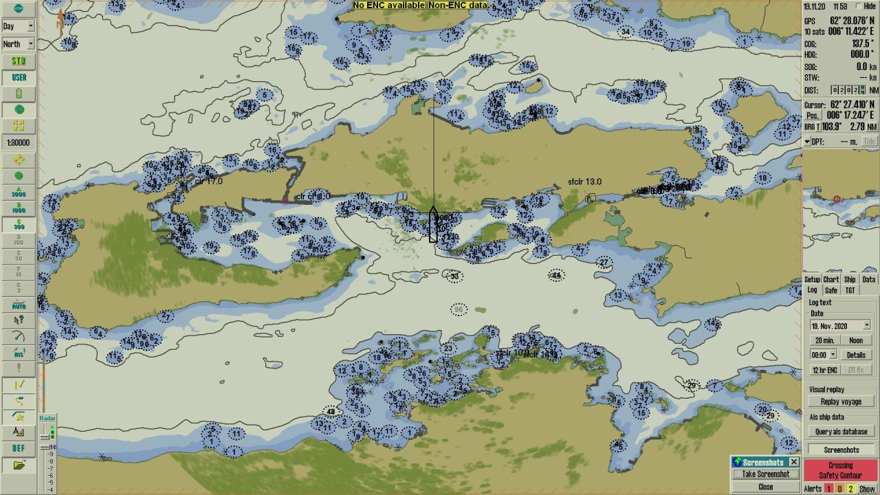
Sail paperless and navigate safely with updated charts. Coastal E er en kartplotter (ECS) Coastal E is an ECS solution approved for paperless navigation for vessels with a Length (L) of up to 24 meters and no ECDIS carriage requirement.
Paperless navigation with Coastal E
APPROVED FOR VESSELS NOT REQUIRED TO CARRY ECDIS
Previously, only vessels with a dual, IMO-approved ECDIS setup could sail paperless. Due to the technical requirements of ECDIS installations including connections to gyro, speed log, AIS and GPS, as well as main and emergency power supplies—installing ECDIS as a replacement for paper charts was rarely feasible for smaller vessels.
The Norwegian Maritime Authority’s circulars RSV 14 2022 (cargo vessels) and RSV 16 2022 (fishing vessels) provide an alternative for vessels up to 24 meters, excluding those still required to carry ECDIS. These circulars allow for an electronic chart solution functionally aligned with ECDIS requirements, where only a wheelmarked GPS or other approved satellite positioning system is required.
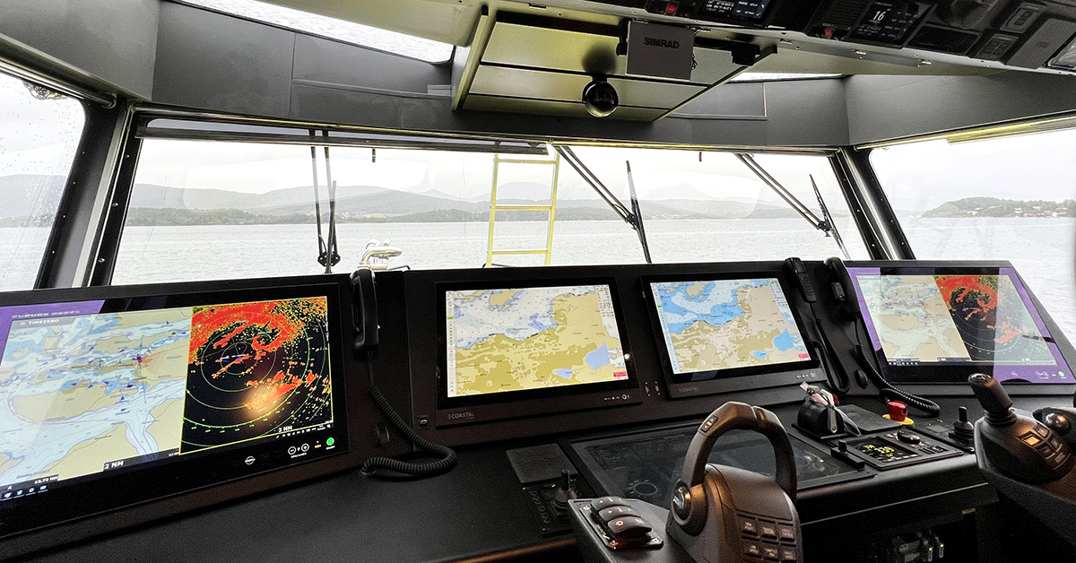
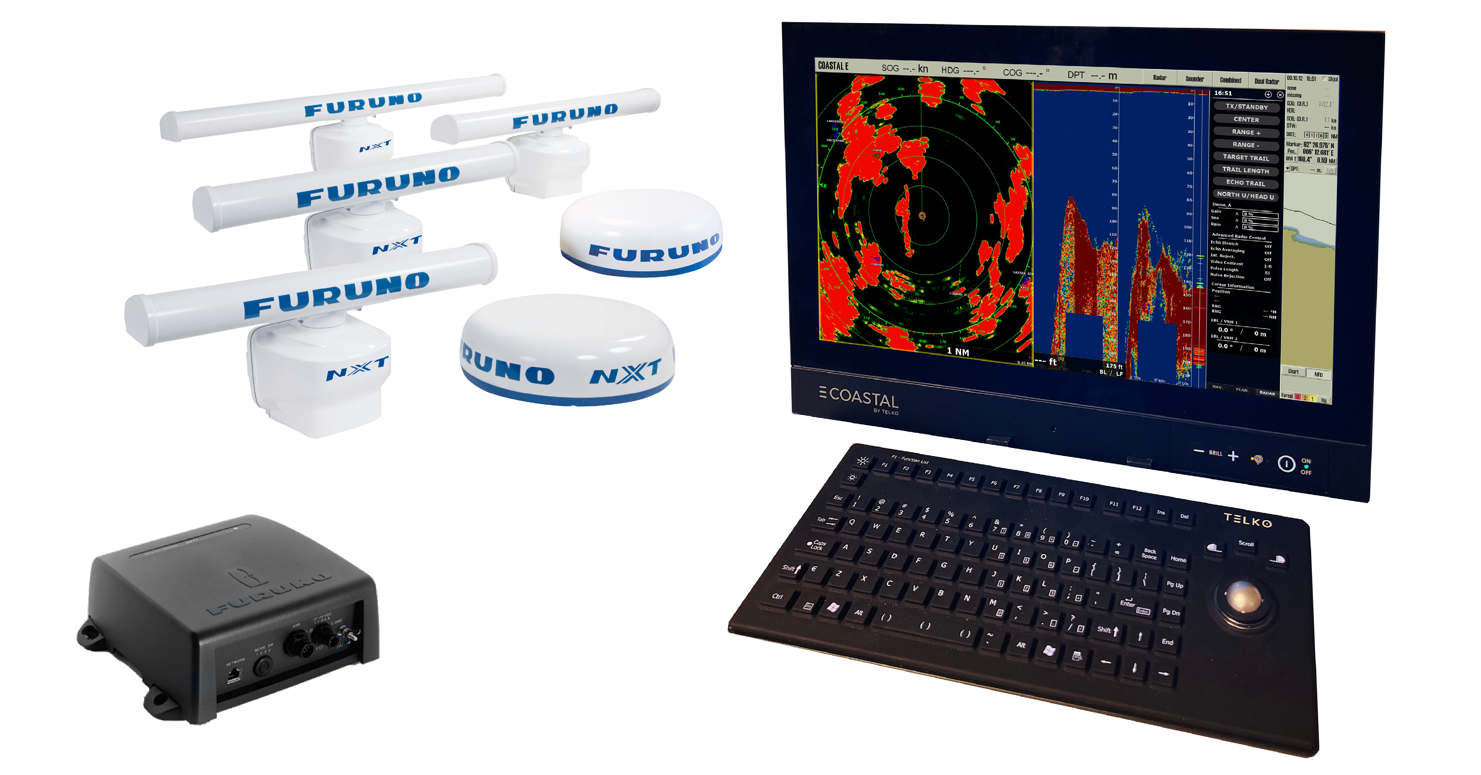
COASTAL E AS A MULTIFUNCTION DISPLAY (MFD)
In a dual Coastal E setup, the backup unit can be configured as an MFD with integrated radar and echo sounder.
Radar integration
- Radar integration is available as an option for Coastal E. Choose from any of our DRS models, except the DRS 4W (wireless). Radar and chart can be shown simultaneously, and split-screen view of radar and echo sounder is also available on the MFD.
Echo sounder integration
WHAT DOES LENGTH (L) MEAN?
Even if a vessel’s total length exceeds 24 meters, the hull design may result in a load line length still under 24 meters. As long as Length (L) is under 24 meters and the vessel is not required to carry ECDIS, Coastal E can replace paper charts for Norwegian vessels in Norwegian waters. Length (L) is usually specified in the vessel’s tonnage certificate. If not, this can be found in the vessel’s stability documentation. In certain cases. In certain cases, it is also possible to apply for an exemption from ECDIS requirements to install Coastal E instead, typically where there is insufficient space for a standard ECDIS installation.
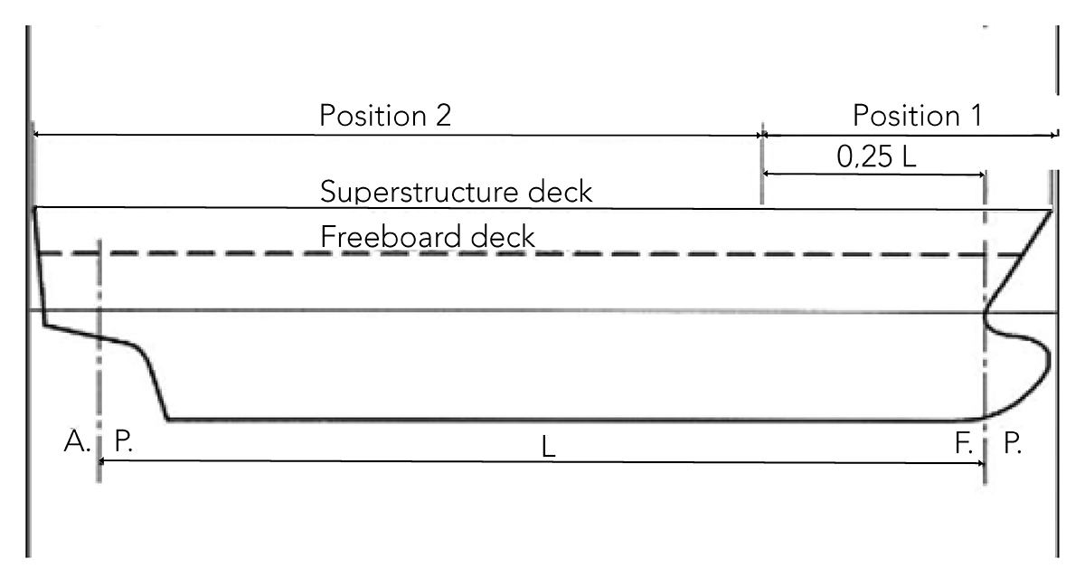
Norwegian regulations use two types of length measurements
- Overall length – total length from the foremost to the aftmost point
- Length (L) – often referred to as load line length, as defined by the International Convention on Load Lines.
The definition of Length (L) originates from the International Convention on Load Lines. In the "Regulation on Measurement of Ships and Mobile Offshore Units" the Norwegian Maritime Authority defined Length (L) in it's “unofficial translation, as understood by the Norwegian Maritime Authority”: "Lengde betyr 96 prosent av hele lengden på en vannlinje ved en dybde tilsvarende 85 prosent av den minste dybden i risset målt fra overkanten av kjølen, eller lengden fra forkant av forstevnen til rorstammens akse på samme vannlinje, hvis denne lengden er større. På fartøyer konstruert med styrlast skal vannlinjen som denne lengden blir målt på, være parallell med konstruksjonsvannlinjen."
SIMPLE CHART MANAGEMENT
With Coastal E and an online solution for electronic chart updates, the workload of manual chart updates is eliminated. You can be confident you’re navigating with the most up-to-date charts.
While within coverage, chart updates for your subscribed charts will automatically be downloaded onto your online solution. A notification appears on the Coastal E display when updates are found, and a single click applies the updates when convenient.
Each chart update generates an automatic log that can be used for compliance documentation related to regular chart updates. If internet connectivity is an issue, updates can also be applied manually via USB stick.
Chart management is significantly simplified with Coastal E and an online delivery system for charts and updates.

Dual Coastal E setup
COASTAL E TRAINING
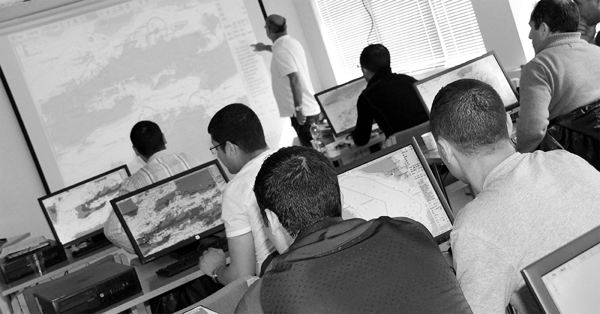
CLASSROOM COURSE (Norwegian only)
According to the "Regulation on Safety Management for Smaller Cargo Ships, Passenger Ships, and Fishing Vessels (1770), §5", navigators must be sufficiently familiar with onboard systems. We recommend a classroom course, offered in Ålesund through our training partner NTNU Ocean Training. The Course information is available in their course catalog. Currently this course is only offered in Norwegian language.
CBT COURSE FOR COASTAL E
A user course is also available as a CBT (Computer Based Training) through Ocean Technology (formerly Seagull).
TELCARE keepS you up to date
With a TelCare-subscription it's easy to keep your Coastal E up to date with all regulatory and performance requirements, as well as flag state requirements. When a new software version is released, all subscribers are notified. It’s simple for onboard personnel to download and install the latest version themselves. A version document describing new and changed features is also made available.
With a TelCare subscription, you automatically gain access to the latest version of Coastal E, including all new features developed based on user input.
Enhanced situational awareness with AIS integration and radar overlay
Electronic charts also enable AIS integration and radar overlay. Tools that significantly enhance situational awareness and improve navigation safety.
Radar overlay also helps you stay aware of the relationship between radar range and chart scale. When these are set too differently, there is a risk of misjudging distances and, at worst, the available time for critical maneuvering.
- With AIS integration, all vessels and their AIS information are shown on the chart.
- Radar overlay presents radar echoes directly on the chart.
AIS and radar overlay can greatly improve situational awareness. Coastal E supports standard AIS telegrams and radar overlay from all IMO-approved Furuno radar models.


